Sunday, June 30, 2013

Homer, not once, but twice

On either side of our excursion to Unalaska, we stayed in Homer, which is on the southern tip of the Kenai Peninsula.

The Homer airport with the Pacific Ocean in the distance.

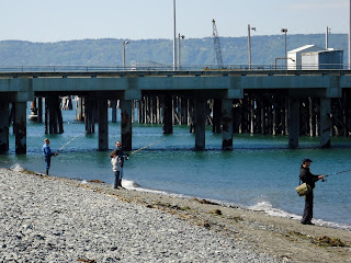
Because we were busy flying in and out, we didn't get to spend as much time there as we might have liked, but we did manage to get out on the Homer Spit, which is 4.5 miles long and extends out into the Kachemak Bay, and is home to the commercial harbor.

Homer Spit from the plane coming in for landing

Besides being the hub of fishing activity,


 and a cool place to view marine wildlife . . .

(Those brown dots are actually sea otters lazing around, a whole raft of them, in fact.)

. . . it is also home to the infamous Salty Dawg Saloon.

The Salty Dawg Saloon (exterior)

The Salty Dawg (interior) with the excellent and very friendly bartender, B.J., working the taps. 
(Just don't ask him to make a Bloody Mary, no matter how fantastic the locals tell you it is! It drives him crazy because it sets off a run of orders that takes him forever to clear.)

While talking to fellow tourists, pilots (one of which Ward knew, which also goes to show what a small world this is), and local fisherman we found out the patron-supplied decor used to be much more extensive, but they had to take it all down to paint the walls and only got a portion of the collection back up. There are still lots of dollar bills signed by visitors from around the world, but the best find to my mind was the Minnesota license plate that said POLICE. B.J. wasn't exactly clear on how it got there (not wanting to incriminate anyone) but he did confirm it came from Minneapolis.

On our second pass through we stopped at the excellent Islands and Oceans Visitor Center, where they had a temporary exhibit on World War II in Alaska, as well as permanent exhibits on indigenous wildlife and the environmental efforts to protect them. We never made it into town during the day, which I'm told has a real artistic vibe, but after dinner we did get a chance to stroll Bishop's Beach, where one can find beautiful, semi-polished rocks brought down by the glaciers as well as naturally occurring coal chunks.


My only regret is we were too early in the season to catch the salmon run, but there's always next time . . .


Monday, June 17, 2013

Cordova, the town that has it all except a bridge.

In the early 1900s, Kennecott Mines was opened,one of the richest copper mines in the world. Deep in the mountains, the mine needed a way to transport all of its copper ore 196 miles to the town of Cordova. Thus the Copper River Northwestern Railway was conceived, and a bridge was built through the mountains.
A sampling of the mountains I'm talking about, with sea fog coming up the fjords.

As the railway approached Cordova, it had to deal with several glacial streams fed by numerous glaciers.

A trestle bridge was built that worked for decades, until the Good Friday Earthquake of 1964, which lifted the town of Cordova six feet, taking one end of the bridge with it. Since the mines had long ago shut down, the railroad secured the bridge from falling, but never rebuilt it. Instead, the Forest Service built a road along the old railroad grade extending from the airport out to the tilting bridge as part of a larger attempt to attract tourists. Unfortunately, Mother Nature had something to say about it, and this bridge to the other bridge washed away sometime in 2012.
(While we were standing here, another large chunk of the road across the river 
broke off and was swept away.)

At first, we were bummed by this development, since the bridge was the only way to reach Child's Glacier, but Ward did a little research, and the next day we took a two hour hike up to the Sherman Glacier, which was stunning in its own right.


Ward walking along the moraine wall of ice, snow, and silt.

In fact, everywhere you look the land around Cordova is being shaped by water. Whether it is the Copper River Delta with all it's mudflats and braided rivers.

Or the slough, where the dusky Canada Goose subspecies resides along with bald eagles and the moose.


Or the glacial rivers, the color of coffee au lait from all the silt (which doesn't harm the salmon at all - it washes right through their gills).
The Copper River at a particularly wide point

Or finally, the rain forest covering the mountain slopes, with its moss-covered landscape fed by sea fog and rain.

The land is alive with water, with a view bound to please almost everyone. I only wish I had more time to hike around. Given the chance, I would come back in a heartbeat. 


Friday, June 14, 2013

Unalaska (Dutch Harbor) and the 1000-mile war

Whenever we mentioned we wanted to fly out to Unalaska, the only other place on U.S. soil to be bombed by the Japanese in World War II, we were told it was too far, the weather too dismal and too dangerous, or else we were met with a blank stare and the question of why? Ward, who is ever ready to take on a challenge, watched the weather forecasts for days, waiting for the right opportunity, which came yesterday, in the midst of our Homer stay.
(I just love how the sweatshirt came with a caution sticker!)

Seven hundred statute miles down the Aleutian Chain from Anchorage, further west than Hawaii (but not nearly as warm) we flew past old volcanoes,
 St. Augustine Island (in sea fog)

active volcanoes,

Mount Pavlof (near Cold Bay, AK)

and beautiful volcanic landscapes that make up the chain.
River on an Unimak Island

The Aniakchak Crater (the least visited National Monument in the country)

After four hours or so, we landed at what once was the U.S. Army's airfield at Dutch Harbor, now the main airport for the island of Unalaska. In our quest for a place to tie down the airplane (perhaps unsurprisingly, the airport doesn't get much in the way of transient aircraft, so they weren't sure where to put us), we ran into Dave, a Medvac pilot, who kindly offered to drive us around the island on an impromptu photo shoot. I was as captivated by the landscape as the World War II buildings that were abandoned at the end of the war. So first, a pictorial ode to the beauty of the island on an absolutely stunning day, so nice I would almost be tempted to move there. Almost.

Dave says there are wild horses on the island, but they were camera-shy for us.

And despite being scarce in the Lower 48, Bald Eagles abound here, 
sometimes congregating in groups of 20-30 birds or more, 
and are found all along the hills surrounding the bays.

And there are indeed signs of the old military encampment everywhere.
An observation post high on the hillside

Panama (rail) Gun Mount for anti-aircraft guns

 Abandoned Quonset hut. 
(Originally the sod would have completely covered it for camouflage.)
Elephant-nose Steel Magazine

Inside the Magazine
(note the office in corner with remnants of a communications panel on the wall inside)

Perhaps the oddest sight to me was to find pillboxes on the sides of residential streets, the town growing up around them, accepting them as part of the landscape, and in some cases using them as fence posts or storage sheds, which, if you know Alaskans, is not out of character.
Pillbox for machine guns w/ town-homes in back

Old Army building in the center of town, re-purposed for civilian use
 next to an abandoned, concrete communications post.

The gorgeous weather couldn't last, of course. We left the next morning in drizzle and fog, but the island was no less beautiful.

Wednesday, June 12, 2013

Mt. McKinley, The High One (Denali)

No matter what name you use, the mountain is awe-inspiring, both in size and in beauty. Normally shrouded in clouds of her own making, she was out in all her glory for the three days we were in Talkeetna.

From the banks of the Susitna River (Talkeetna, AK), some forty miles away.

Because it was so clear, Ward flew me around the peak on Friday. He took us up to 14,500 feet, and still the mountain towered above us.

We flew over the base camp for a set of climbers beginning their several day trek up the peak.

What looks like confetti strewn across the snow are actually tents, the two planes show much larger than they appear. The base camp is around 8000 feet, so well below us.

The use of a base camp is a relatively new occurrence, made possible by advances in aviation during World War II. Before that, climbers would start from Talkeetna (a town with a orange Manx cat named Stubbs as its mayor) with several weeks of hard travel before they even attempted to summit.
Approaching the mountain up the Ruth River valley.

The "small" mountains early climbers would have to traverse on their way to the base of Denali, 
where they would start their real climb.

One of three glaciers climbers would use to speed their approach. I believe this is Kahiltna Glacier, 
though I'm not sure since we were actually a little lost at this point.

Even though glaciers are called rivers of ice, I was surprised to find they are far from smooth.

One of the smoother sections, but note all the lakes and crevasses. 
I can't imagine crossing one would be much fun.

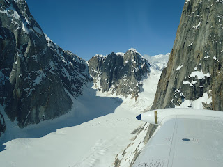
On the way down, we flew through one of the glacial canyons 
on the flanks of Denali, to check out the scenery.


Even though this year the weather has so far allowed an 80% success rate for ascending the mountain, on average only 50% of all climbers reach the peak, which is not surprising since the wind can blow across the ice fields in excess of 80 miles an hour and the weather can turn on a dime.
Here you can see the clouds forming along the peak, filling and obscuring the valleys and crevices, and
making climbing much more difficult for those on the mountain.

And while Alaska is rife with heroic tales of aviators flying this wild and beautiful land, one of the best known and most beloved was Don Sheldon (1921-1975), who perfected the art of glacier flying and high-altitude rescues. After seeing first-hand the places where he would have landed, my respect for his courage and skill are immense.

Don Sheldon in front of the hangar, then.

Don Sheldon's hangar (from the other side), today.


Tuesday, June 11, 2013

How a Twenty-Dollar Bill Brought the Train in On-Time

Before airplanes, the main arteries of civilization were rivers, and the railroad, with miles and miles of track being laid from the coast deep into the interior regions. At first the trains ran supplies out to the gold mining regions, but soon they were supplying all the little communities that popped up along the way.

The Alaskan Range from the side of the tracks (Hurricane, AK).

While in Talkeetna, we went on one of the last flag trains in Alaska, where would-be riders need only flag the train to get it to stop. Called the Hurricane Turn, it ran 110 miles from Talkeetna to Hurricane Gulch and then back.


With almost no scheduled stops, Conductor Warren was free to stop the train not just wherever a passenger wanted to get off (sometimes seemingly in the middle of nowhere only to be told by Warren that there was a cabin over the rise, or a trail head not far off) but also at various scenic overlooks, or to show off his favorite camping spot on the Indian River, and for any wildlife sightings along the way.

Bank of the Indian River, 
near Conductor Warren's favorite camping spot.

Trumpeter Swan nest seen from the train.


Trestle Bridge along the route

Hunters, campers, rafters as well as residents of small communities use the train on a regular basis. One stop is at the smallest town in Alaska, population 2. Another is at the ghost town of Curry, which was once a thriving resort, with a three-hole golf course, a ski hill, and a 170-room hotel, as well as a refueling stop for the steam engines headed farther north. Once diesel engines entered the picture, and trains no longer needed to stop for refueling, the town slowly dwindled through the 1950s, only to die completely with the burning down of the resort in 1957 and the closing of the post office a few years later.


Alaska's smallest town (population 2)

From Conductor Warren we also learned conductors are responsible not only for keeping the train on schedule, but also for checking the engine speedometer for accuracy at the beginning of each trip. Nowadays they do this by means of a GPS, but in the old days, before the use of welded rails, the engineer would have to count the number of clicks he heard in a space of twenty-seven seconds as the train passed over the rail joints (bolted rail has gaps at each joint, whereas welded does not) with the conductor marking the time. The number of clicks would equal the speed in miles per hour, telling the conductor how accurate or inaccurate the speedometer was, so he could make the necessary adjustments in his timekeeping.

He also said a good conductor should know how to motivate his engineers. For instance, his current engineer will do almost anything for a free pizza, where as one of his former engineers, one that ran the longer route from Denali to Anchorage, loved beer. On one trip, the engine caught fire not long after they had left Denali, requiring a change of trains in Healy and an hour delay. With a little over 200 miles before they reached Anchorage, he knew they could make up the time - if the engineer had the right incentive. So Warren went up to the front, taped a twenty-dollar bill to the windshield and told the engineer, "Get us to Anchorage on time and the first round is on me."

Looking down from the bridge spanning Hurricane Gulch.

The train came in on time.